These Proposed Plans will Destroy Seagrass, Coral and Conch.
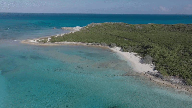
This is a map of the North Bay of Sampson Cay with the proposed Yntegra & Rosewood Hotels’ seawall, supply dock and supply vessel route indicated in red andyellow.
In yellow: The only route available for commercial shipping vessels and barges due to the shallow rocks and sand bars of this area. This route will require dredging through seagrass and coral to allow even the lowest draft ships to access the proposed supply dock. And, the supply vessels must travel within 200 feet of two recreational beaches and directly through several active snorkeling and diving areas, endangering recreational swimmers.
In red: The Yntegra/Rosewood Hotels’ proposed service dock and massive seawall. The service dock would require dredging through seagrass and coral and the seawall would stretch into the North Bay, cutting across the channel, completely blocking the cut and disrupting the bay’s natural current and tide flow.
We've documented the marine life existing in the North Bay with geo-tagged underwater photos. Click the green photo icons to see the fragile ecosystem that is at risk from this unnecessary supply dock that could easily be located on the South end of the island where Yntegra and Rosewood Hotels intend to dredge out two massive marinas.
Save North Bay: Stop The Dredge
SEA member Turtlegrass Resort has released a video illustrating what Yntegra's publicly filed plans would mean for North Bay, Exuma.
Using professional CGI, the video illustrates the impact of the proposed dredging, commercial shipping traffic, and industrial and back-of-house facilities would have on the North Bay all based on Yntegra’s publicly filed plans.
Exuma Deserves responsible development!
Help us protect Sampson Cay. Share this map today.
Subscribe for SEA updates
Get the latest news, stories, and ways to take action, straight to your inbox.